
🌍 ESRI - Mapping the World
Overlooked #206
Hi, it’s Alex from 20VC. I’m investing in seed & series A European vertical solutions (vSol) which are industry specific solutions aiming to become industry OS and combining dynamics from SaaS, marketplaces and fintechs. Overlooked is a weekly newsletter about venture capital and vSol. Today, I’m sharing a deep-dive on ESRI: $1bn+ in revenues, founders-owned, bootstrapped and category leader in mapping software.
ESRI is a fascinating business.
It’s one of the largest private and founders owned software companies. $1.3bn in revenues. 100% owned by its founders Jack & Laura Dangermond.
It created and dominates a category called Geographical Information Systems (GIS). GIS = map + database + workflow.
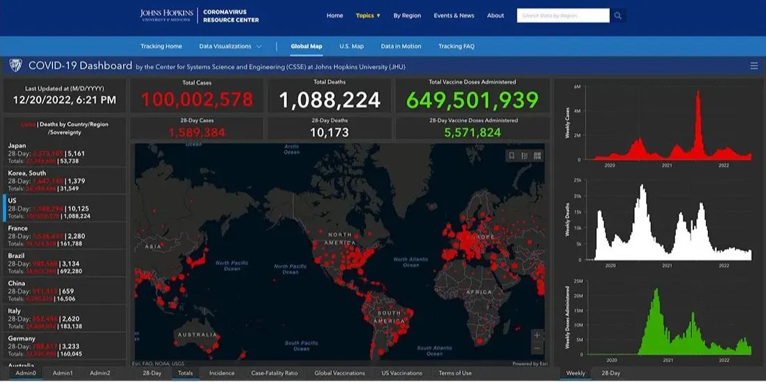
For instance, during covid, John Hopkins used ESRI to build a covid map to track globally the number of cases, deaths and vaccines. Everyone could look at the map but it was also a detrimental resource to organise the covid response with governments, NGOs and pharma companies.
In this post, I will dig into (1) key learnings from ESRI, (2) ESRI’s history, (3) ESRI’s product overview and (4) how to disrupt ESRI?
Why ESRI Matters?
ESRI is one of the most successful vertical software platform. It operates in the GIS (Geographic Information Systems) software market. GIS is the software used to capture, analyze, visualize and manage geographical data. ESRI created this category. Today, it generates over $1.3bn in revenues, had 350k customers and has a dominant 40%+ market share.
ESRI is private & 100% owned by cofounders. Jack and Laura Dangermond cofounded ESRI in 1969. They grew the business to an impressive scale without ever raising external capital (debt, venture capital) or generating liquidity (secondary, IPO).
ESRI’s platform combines data, maps and workflows. It aggregates geospatial public and private data sources that customers can combine with their proprietary data sources. ESRI enables companies to display this unique data into a super granular mapping system that can be activated with workflows to solve specific problems.
ESRI has built a massive public sector business. The company started with government customers (cities, states, countries) before expanding into commercial. Today, 40% of revenue stem from government. It works with 30k cities and local governments. In the US, all the 50 states are customers.
ESRI has built a real ecosystem around its core platform. ESRI generates $1.3bn in revenue but its ecosystem of franchises and partners are generating $28bn in revenue building on top of its core platform. ESRI is focusing on building the best mapping infrastructure and to aggregate the most relevant data-sets. In most foreign countries, ESRI partners with local entrepreneurs via a franchise model to create exclusive national distributors who will localise the platform and the go-to-market. It also partners with applications and solution developers who will build applications on top of the core ESRI platform.
ESRI quickly secured global market leadership through strong local partnerships. ESRI had a first mover advantage creating and leading the GIS software market. Despite being bootstrapped, ESRI expanded internationally at an aggressive pace. It opened its UK office less than a decade after inception and secured exclusive distribution agreements with local partners across key global markets.
ESRI provides its software for free to universities training students to become core users before they move to the job market. It’s a smart long-term play that design-centric companies like Adobe, Autodesk, and Dassault have mastered. You winning your market by making your software the default workspace for successive generations of students.
ESRI has a unique company culture. It implemented multiple unique operating systems: (i) real-time compensation where many employees are paid hourly rather than a fixed yearly salary, (ii) 20% of the company’s profits are redistributed to employees, (iii) no sales commissions to avoid taking advantage of customers, (iv) cultivating a culture of service towards the customers similar to what you would find in servicing businesses (healthcare, restaurants, home services).
Company’s History: A General Evolution From On-Premise to SaaS, From Governments to Private and From the US to the World
In 1969, Jack and Laura Dangermond founded ESRI (Environmental Systems Research Institute) in California - initially as a land-use consulting shop. While working at Harvard’s Laboratory for Computer Graphics and Spatial Analysis in the mid-1960s, they witnessed the birth of early mapmaking software in academia and saw the potential to expand beyond academia.
In the 1970s, ESRI started to ship its first contract mapping services at scale for the Maryland state and for water resource management in Delaware. ESRI started by targeting the public sector before expanding into infrastructure-heavy sectors like transportation and utilities. Today, the growth is driven by emerging commercial verticals like real estate and retail.
In 1976, ESRI started to expand abroad with the UK. ESRI’s geographical expansion is based on a hybrid strategy combining wholly owned subsidiaries in key markets (Canada in 1984, France opened in 1988 or Italy in 1990), independent distributors authorised to resell ESRI in their regions and business partners integrating, reselling or building solutions on top of ESRI technology. Today, ESRI has offices in 49 countries, works with 3k partners globally and has international distributors providing local support in over 100 countries.
In 1981, it released its first commercial ready GIS called ARC/INFO. The software’s name reflected its architecture: “ARC” provided geographic input, processing, and output tools, while “INFO” handled the relational database.
In 1986, it released GIS to personal computer enabling democratisation beyond minicomputers and workstations. In 1989, it signed a $10m contract from the Defense Mapping Agency to build the Digital Chart of the World. It was a turning point for the company, both in scale and brand recognition.
In the late 1990s, Esri transformed ARC/INFO into a modular, scalable GIS platform and shifted its focus from contract mapping services to building and selling mapping software products.
In 2012, ESRI launched ArcGIS Online as its first SaaS offering. In 2015, it launched ArGIS Pro also available as a SaaS offering and with integrated 2D and 3D features. With these two launches, ESRI started to transition customers from on premise to cloud and from perpetual licenses to subscription licenses.
ESRI has also made multiple acquisitions to add tech capabilities to its platform like mobile location from its Goloqi’s acquisition in 2012, indoor positioning from its indoo.rs acquisition in 2019 and 3D visualisation from its Zibumi acquisition in 2020.
In 2024, it launched AI assistants across multiple products including ArcGIS Pro, Survey123 and Business Analyst.
With Jack Dangermond turning 80, Esri now faces a key question of succession that could reshape both its ownership and long-term direction.
Product Overview
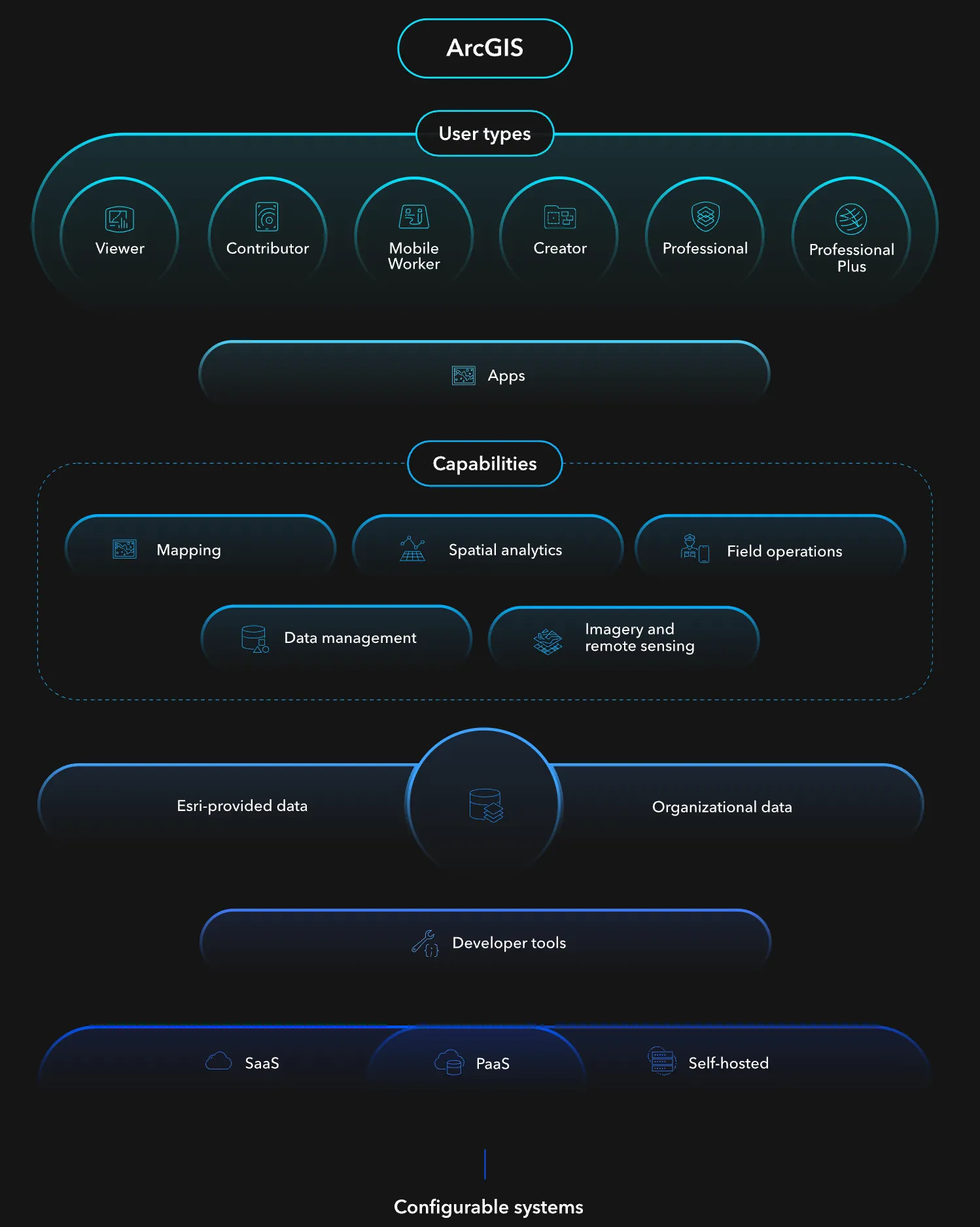
ESRI is a Geographic Information System (GIS). It connects data with geography combining location data (i.e. where things are) with descriptive data (i.e. attributes, what those things are). It can be broken down into 3 layers:
Data management: system of records of location data that can come from multiple sources (internal data, public data, private data) and that can be matched with attributes.
Mapping and spatial analysis: generation of maps stacking multiple data sources and analysis of geographical relationships.
Dashboards, workflows, and applications that turn data into actionable insights for organizations.
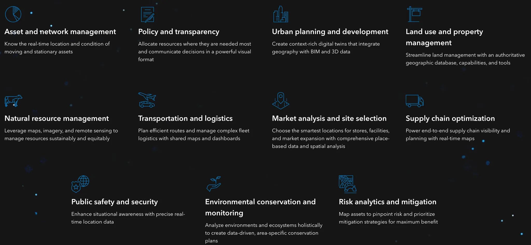
ESRI is an horizontal platform with multiple use cases. It’s used by 33k businesses, 12k national government agencies, 40k cities & local governments and 15k non-profits. For instance:
In retail, ESRI is used to find the perfect location to open new stores (combining map based analytics with demographic, lifestyle and spending data), to set-up the right marketing strategy to engage with new/existing customers or to optimise a supply chain (stores, warehouses, transportation assets).
In energy, ESRI is used by BP to create a single source of truth across its reservoirs, wells and data pipelines. This source of truth helps them with environmental monitoring and emergency response.
In telco, ESRI is used by Verizon for network planning and deployment. For instance, you need to know the population density of a given area and certain areas of interest with specific regulations like a school, an hospital or a military base.
In real-estate, ESRI is used by Mid-America Real Estate Group to layer demographics, consumer behavior, trade areas, drive times, and competitor data to help their brokers identify optimal locations for clients.
In healthcare, ESRI was used by Johns Hopkins to provide a COVID tracking dashboard to have a visualisation of where cases here increasing or decreasing and where NGOs & individuals could provide assistance.
In governments, ESRI is the system of records for surveyors and cadastral work in the 50 U.S. states and for use cases like asset tracking (buildings, roads, trees), maintenance planning (e.g. snowplow routes), police resource allocation or demographic forecasting.
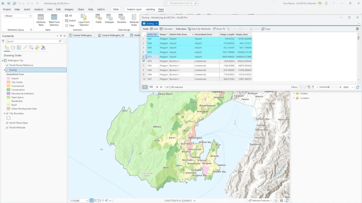
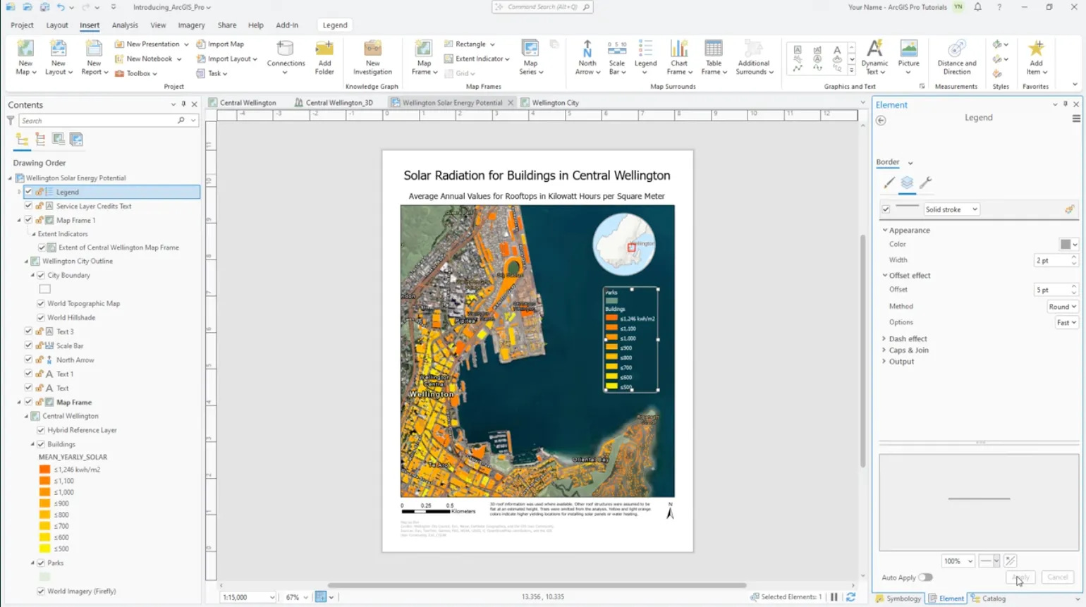
I watched several product demos of ESRI’s core product which is ArcGIS Pro. It’s a complex product with a steep learning curve. To properly set-up and maintain data and workflows, you need to have an ESRI’s expert either in-house or contracted with a consultancy. ArcGIS Pro has the following core features:
Users can overlay different 2D and 3D layers on a map using in-house or external data-sets (e.g. buildings, income data, demographic density, solar exposure, land registry, etc.).
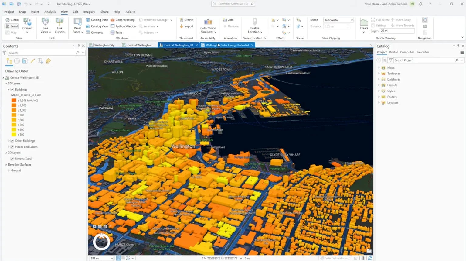
Behind each point of interest in the map, you have a database similar to Airtable that can be modified and enriched where each line is a point of interest with all its attributes.
The map becomes actionable via a document/slide editor similar to Canva or workflows.
How to Disrupt ESRI?
ESRI’s most common criticisms are the following: (1) expensive & continuously rising prices, (2) hard to implement, use & integrate, (3) not cloud/mobile/AI native, (4) requiring massive customisation to serve a specific use case & industry and (5) ongoing transition beyond its original founders that is slowing down the evolution of the platform.
I believe that you have three obvious paths to go after ESRI:
Applying Figma’s playbook for GIS: building a web-based, collaborative, easy-to-use and freemium’s alternative,
Using AI with “prompt to mapping” to leapfrog the work that an ESRI’s core user would do on the platform to generate a map and build a workflows of it,
Unbundling ESRI’s playbook (map + database + workflow) on a given vertical (e.g. public, retail, real estate, transportation or utilities) or on a given use case (e.g. site selection, asset maintenance).
Thanks to Julia (🦒) & Fredrik for the feedback! Thanks for reading! See you next week for another issue! 👋
Fantastic deep dive, Alex.
Nice summary 👏. I think a modern, cloud native, version of ESRI is Felt maps. Check it out!